
Thermal drone
deer surveys.
Night thermal drone surveys for deer and wildlife across South Louisiana. A full-property count, density estimate, and a map of every detection.
Most herd numbers are estimates.
Trail cameras and spotlight counts only see part of the picture.
Cameras watch a handful of trails, and a spotlight count misses more than half the deer, including the ones bedded in cover. Harvest numbers, buck-to-doe ratios, and food-plot planning all depend on the herd estimate. A thermal survey replaces that estimate with a count: in one cold night, a drone reads the body heat of the deer across the property, in the open and in cover.
How thermal imaging works.
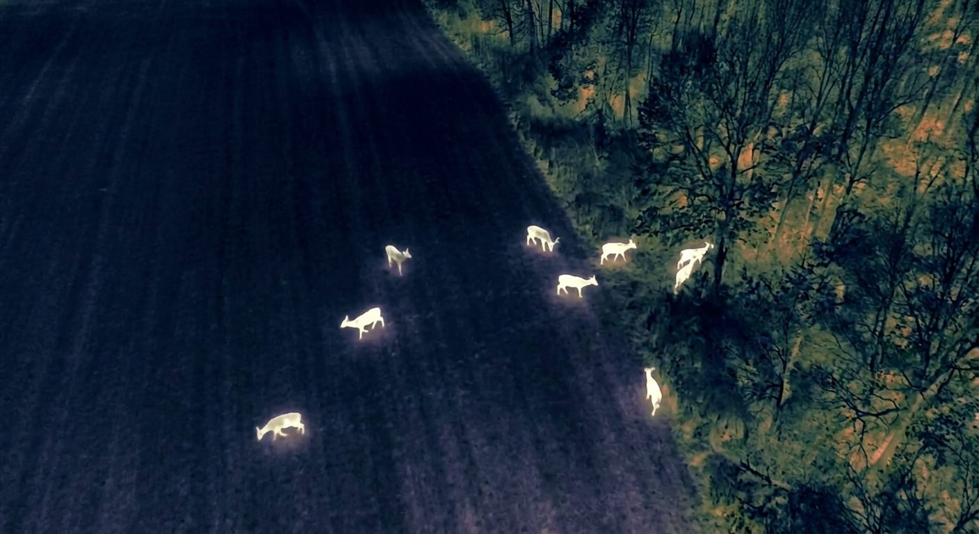
A 640×512 radiometric thermal sensor picks up a deer’s body heat. Bedded in a thicket, tucked against a tree line, or moving at the field edge, it shows up the same. Deer that a spotlight or a trail camera would miss are clearly visible from above.
What the survey measures.
Every survey reports the following, for properties around Baton Rouge and across South Louisiana.
The report.
A sample of what you receive after a flight: the numbers, the map, and the conditions they were flown in.
A standardized survey method.
We fly at night or first light and lean into the cooler, leaf-off stretches when a deer stands out sharpest from the ground behind it. Systematic transects so nothing gets counted twice or missed. The raw count is corrected with distance sampling to account for the deer any survey misses.
What thermal can and can’t do.
Thermal finds the deer. A zoom pass classifies what it can, but straight down in the dark not every animal can be sexed, and heavy pine or evergreen canopy hides some of them. We report the ratio the footage supports, and note where the number is solid and where it is an estimate.
From count to plan.
A survey is most useful as the starting point for a management plan. Booked with a Habitat Reset, the survey cost credits toward the program. Tell us about your property and your goals, and we can put a survey and a plan together.
How it works.
Plan
Map the property, pick the right night, and clear the airspace.
Fly
Systematic transects over the whole place, radiometric thermal, at night or first light.
Analyze
Distance-sampling density, a blind multi-observer count, and a zoom pass to classify.
Report
Your count, mapped, interpreted against the habitat, with recommendations.
Frequently asked questions.
When is the best time to survey?
Cool, leaf-off, overcast nights give the sharpest count, and in Louisiana that’s usually late fall through winter. We can fly outside that window too; we just plan around warm nights and heavy canopy so the numbers still hold up.
How accurate is it, really?
Thermal picks up on the order of 80 to 90 percent of the deer on a pass, far more than a spotlight, and after distance-sampling correction the density lands within a few percent of a well-run trail-camera survey. We fly the property the same way every year, so your numbers are comparable season over season.
Can you tell bucks from does?
Partly. Thermal finds the deer; a zoom pass classifies buck, doe, and fawn where the footage is clear. Straight down in the dark, some animals can’t be sexed with confidence, so we report the ratio the footage supports and tell you where it’s an estimate.
Is it legal to fly deer at night?
Yes, done right. Survey flights run under FAA Part 107 night rules with anti-collision lighting, on FAA-registered aircraft, under the LDWF permitting that clears the federal Airborne Hunting Act. Near controlled airspace, flights are cleared through LAANC.
Will the drone spook my deer?
Flown at survey altitude, no. We stay high enough that deer don’t flush, which is a big part of why the count holds together.
How big does my property need to be?
It works from a small tract up to thousands of acres; we cover several hundred acres in a single session. Smaller places are welcome, and we’ll tell you honestly if a survey is worth it for your acreage.
Schedule a survey.
Tell us about your property and roughly how many acres, and we’ll go from there.
Flown under FAA Part 107 and LDWF rules